

The little blue dot on your phone map feels like magic. You’re standing in a city you’ve never visited, and your phone knows exactly where you are — down to which side of the street you’re on. I got curious about this on a hiking trip when my phone kept tracking me perfectly with zero cell signal. No bars, no WiFi, and it still knew where I was. How? The answer involves 30+ satellites, atomic clocks, and some genuinely elegant math. Let me walk you through it without the physics textbook.
We break down how to backup an android phone step by step in a separate guide.
- The 30-second version
- The satellite constellation: who’s up there
- Trilateration: the math that finds you
- Why timing is everything (atomic clocks)
- Why GPS is free (and who pays for it)
- Why your blue dot drifts
- GPS vs cell towers vs WiFi positioning
- What GPS can’t do
- Frequently Asked Questions
The 30-Second Version
Your phone listens to radio signals from GPS satellites orbiting Earth. Each satellite constantly broadcasts “I’m satellite #7, and the time is exactly X.” Your phone picks up these broadcasts from multiple satellites, measures how long each signal took to arrive, and from those travel times figures out how far away each satellite is. With distances to at least four satellites, it can calculate your exact position. That’s the whole system: satellites shouting the time, your phone doing geometry.

The Satellite Constellation: Who’s Up There
GPS is run by the U.S. Space Force (originally built for the military, opened to civilians in the 1980s). The system needs a minimum of 24 satellites for global coverage; there are usually 31+ active at any time, orbiting about 12,550 miles (20,200 km) above Earth.
Each satellite circles the planet twice a day, and they’re arranged so that from anywhere on Earth, you can “see” at least four satellites at any moment — usually six to eight. Your phone doesn’t talk to the satellites; it only listens. The satellites broadcast constantly, and your phone passively receives. This is why GPS works with no cell signal and doesn’t use your data plan — it’s one-way radio, like listening to FM.
One detail I love: the satellites are basically flying clocks. Their main job is broadcasting extremely precise time, and everything else follows from that.
Trilateration: The Math That Finds You
This is the core trick, and it’s simpler than it sounds. (Note: it’s tri lateration — measuring distances — not triangulation, which measures angles. Everyone mixes these up, including most articles.)
Imagine you’re lost and you ask three friends where they are:
- Friend A says “I’m 5 miles from you.” That puts you somewhere on a circle 5 miles around A.
- Friend B says “I’m 7 miles from you.” Now you’re at one of the two points where A’s circle and B’s circle overlap.
- Friend C says “I’m 4 miles from you.” That third circle crosses at exactly one of those two points. That’s you.
GPS does this in 3D with satellites instead of friends. One satellite gives you a sphere of possible positions. Two satellites narrow it to a circle where the spheres intersect. Three satellites narrow it to two points — and one of those points is usually in outer space or inside the Earth, so your phone discards it. The fourth satellite confirms the answer and adds altitude plus a critical timing correction.
Your phone does this calculation continuously, many times per second, which is why the blue dot moves smoothly as you walk.
Why Timing Is Everything (Atomic Clocks)
Here’s where it gets impressive. Radio signals travel at the speed of light — about 186,000 miles per second. To measure distance from signal travel time, your phone needs to know exactly when the signal left the satellite and exactly when it arrived.
The satellites carry atomic clocks accurate to within billionths of a second. Your phone’s clock is nowhere near that precise — it’s a cheap quartz oscillator. So how does the math work?
This is what the fourth satellite is for. With three satellites, tiny errors in your phone’s clock would throw the position off by miles. The fourth satellite’s signal gives the phone enough information to solve for the clock error too — it essentially figures out “my clock is off by X microseconds” and corrects for it. Four satellites = three dimensions of position + one dimension of time. Elegant, right?
To put the precision in perspective: a timing error of just one microsecond (one millionth of a second) translates to a position error of about 1,000 feet. The system is measuring time differences thousands of times smaller than that.

Why GPS Is Free (and Who Pays for It)
GPS costs you nothing because the U.S. government pays for it — about $2 billion a year to maintain the satellite constellation. It started as a military system, and keeping it free for global civilian use turned out to be enormously valuable for the world economy (shipping, aviation, agriculture, your food delivery app).
Worth knowing: GPS isn’t the only system. Russia runs GLONASS, the EU runs Galileo, and China runs BeiDou. Your phone probably uses several of these at once — modern phones listen to GPS, GLONASS, and Galileo simultaneously, which is why location is faster and more accurate than it was ten years ago. More satellites in view = better math.
Why Your Blue Dot Drifts
If the system is so precise, why does your blue dot sometimes show you in the river next to the road? Several real-world things degrade the signal:
- Buildings: In downtown areas with tall buildings, signals bounce off glass and concrete before reaching you. Your phone measures the bounced signal’s longer travel time as a longer distance — and miscalculates. This “multipath error” is the #1 cause of urban GPS weirdness.
- Tunnels and parking garages: No line of sight to satellites = no GPS. Your phone guesses based on your last known position and speed until you emerge.
- Atmosphere: The signals slow down slightly passing through the ionosphere. The system corrects for most of this, but not all.
- Trees and heavy cloud cover: Dense canopy can weaken signals enough to hurt accuracy. Your hiking app showing you 50 feet off the trail? That’s usually why.
- Your phone’s cheap antenna: Phone GPS antennas are tiny and compromise-prone. A dedicated hiking GPS unit with a bigger antenna will outperform any phone in tough conditions.
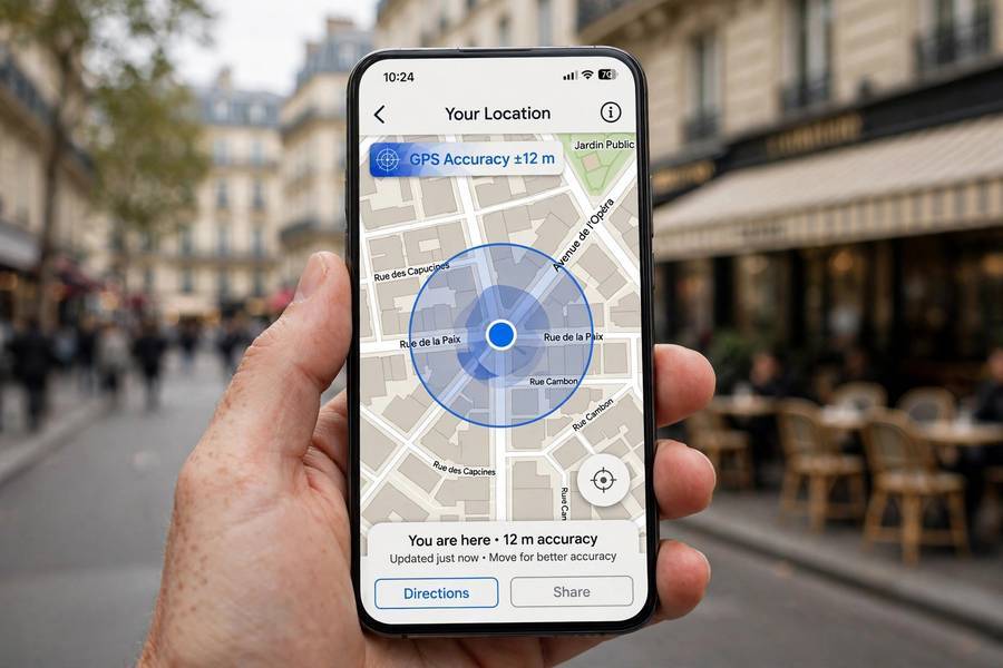
Typical phone GPS accuracy is 10–30 feet in open sky, and it can degrade to 100+ feet downtown. Good enough for navigation, not good enough to find your keys.
GPS vs Cell Towers vs WiFi Positioning
Your phone doesn’t rely on satellites alone. It fuses three positioning methods, and knowing the difference explains a lot of weird behavior:
- GPS satellites: Most accurate (10–30 ft), works anywhere with sky visibility, but slow to get the first fix (30 seconds to a few minutes from a cold start) and useless indoors.
- Cell tower triangulation: Your phone measures signal strength from nearby towers. Accuracy: a few hundred feet to a couple miles. Fast and works indoors-ish, but vague.
- WiFi positioning: Your phone scans nearby WiFi network names and looks them up in a giant database (Google and Apple have mapped billions of networks). Accuracy: 30–100 feet in cities. This is why your blue dot works inside a shopping mall — it’s not GPS, it’s WiFi.
When you open Maps indoors and it instantly knows where you are, that’s WiFi positioning doing the work. When it takes a while to lock on in a new city, that’s GPS doing a cold start — downloading satellite orbit data from scratch.
For a deeper dive, see our guide to how wifi works.
What GPS Can’t Do
A few honest limitations, because the marketing suggests otherwise:
- It can’t see through roofs. Indoors, GPS is mostly dead. Your phone switches to WiFi and cell positioning without telling you.
- It can’t track you in real time with zero delay. There’s always a second or two of lag. That’s why navigation sometimes tells you to turn just after you’ve passed the turn.
- It doesn’t work at the poles as well. Satellite coverage is optimized for populated latitudes. It works at the poles, just less reliably.
- It can be jammed or spoofed. GPS signals are incredibly weak by the time they reach Earth — about as faint as a lightbulb viewed from 12,000 miles away. Cheap jammers can block them (illegal in most countries), and spoofing — broadcasting fake satellite signals — is a real concern for ships and aircraft.
- It drains battery. The GPS radio is one of the hungriest components in your phone. An hour of navigation can eat 20–30% battery, which is why your phone gets warm on long drives.
Frequently Asked Questions
Yes. GPS is a one-way radio broadcast from satellites — your phone only listens, so it needs no cell signal, WiFi, or data. That’s why hiking apps track you in the backcountry. (Downloading offline maps beforehand helps, since the map images themselves do need data.)
No. Receiving GPS satellite signals uses zero data. However, the map app showing you streets and satellite imagery does use data to download map tiles — download offline maps if you’re going off-grid.
Typically 10–30 feet in open sky. Downtown among tall buildings, accuracy can drop to 100+ feet due to signals bouncing off buildings. Indoors, your phone switches to WiFi and cell-tower positioning instead.
From a “cold start” — when the phone hasn’t used GPS in a while or you’ve traveled far — it must download satellite orbit data, which takes 30 seconds to a few minutes. After that first lock, fixes are nearly instant because the phone remembers where the satellites are.
Barely. Satellite signals are too weak to penetrate roofs reliably. Indoors, your phone uses WiFi network positioning and cell towers instead — which is why indoor location works in malls but feels less precise.
Yes, it’s free to use worldwide. The U.S. government funds the GPS constellation (about $2 billion/year) as a public service. Your phone just needs a GPS receiver chip — which every smartphone has — and there’s no subscription or usage fee.