Nepal Flood: 5 Missing, Villages Swept Away in Budhi Gandaki Disaster

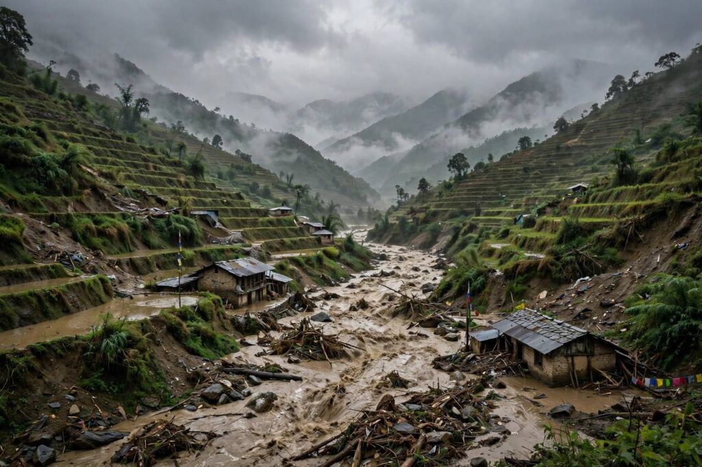
A devastating Nepal flood struck the country’s central Gorkha district before dawn on Sunday, October 11, 2026, when a landslide-blocked river burst its banks and sent a wall of mud and debris down the Budhi Gandaki valley. Five people are missing, dozens of homes were swept away, and more than 100 foreign trekkers are stranded after bridges and trails were destroyed. Here is everything we know.
The short version: around 5:30 a.m. on October 11, a major landslide between Lokpa and Chumling blocked the Budhi Gandaki River in Gorkha district; the blockage failed and released a flash flood carrying debris downstream, destroying homes, bridges, and hydropower infrastructure, according to Nepal’s National Disaster Risk Reduction and Management Authority (NDRRMA), via ReliefWeb.
What Happened in the Nepal Flood
The disaster began with what officials described as a dry landslide that dammed the river near Chumchet in Chum Nubri Rural Municipality-6. Water piled up behind the natural dam until it burst, sending a surge of black, debris-laden water down the narrow valley. Videos circulating online showed the swollen river tearing through hillsides in Gorkha, about 100 kilometers west of Kathmandu.
“What we know is that a dry landslide had blocked the river and then it burst to cause the flood,” national disaster agency chief Dharam Raj Uprety told AFP, as reported by UCA News. The International Centre for Integrated Mountain Development (ICIMOD), the Kathmandu-based intergovernmental body, said in a preliminary assessment that the flood likely began around 4 a.m. Nepal time and was probably triggered by the failure of the temporary landslide blockage, according to Public TV English.
Casualties, Missing, and Damage
Five people remain out of contact, two women and three men from the Chumchet area, according to the NDRRMA situation report. Early SMS warnings helped many residents flee to higher ground before the surge arrived. “Our house is gone, we have no electricity… but there have been no casualties,” one local official told reporters, reflecting the mix of destruction and relief that warnings saved lives.
The physical damage is extensive: around 40 to 45 houses swept away, three hydropower projects damaged (including a 341-MW Budhi Gandaki site), four to six bridges destroyed, a primary school destroyed, and trails along the popular Manaslu trekking route washed out, according to The Wire and UCA News. Salleri Bazaar and Jagat Bazaar along the river suffered severe destruction.
Rescue Operations and Stranded Trekkers
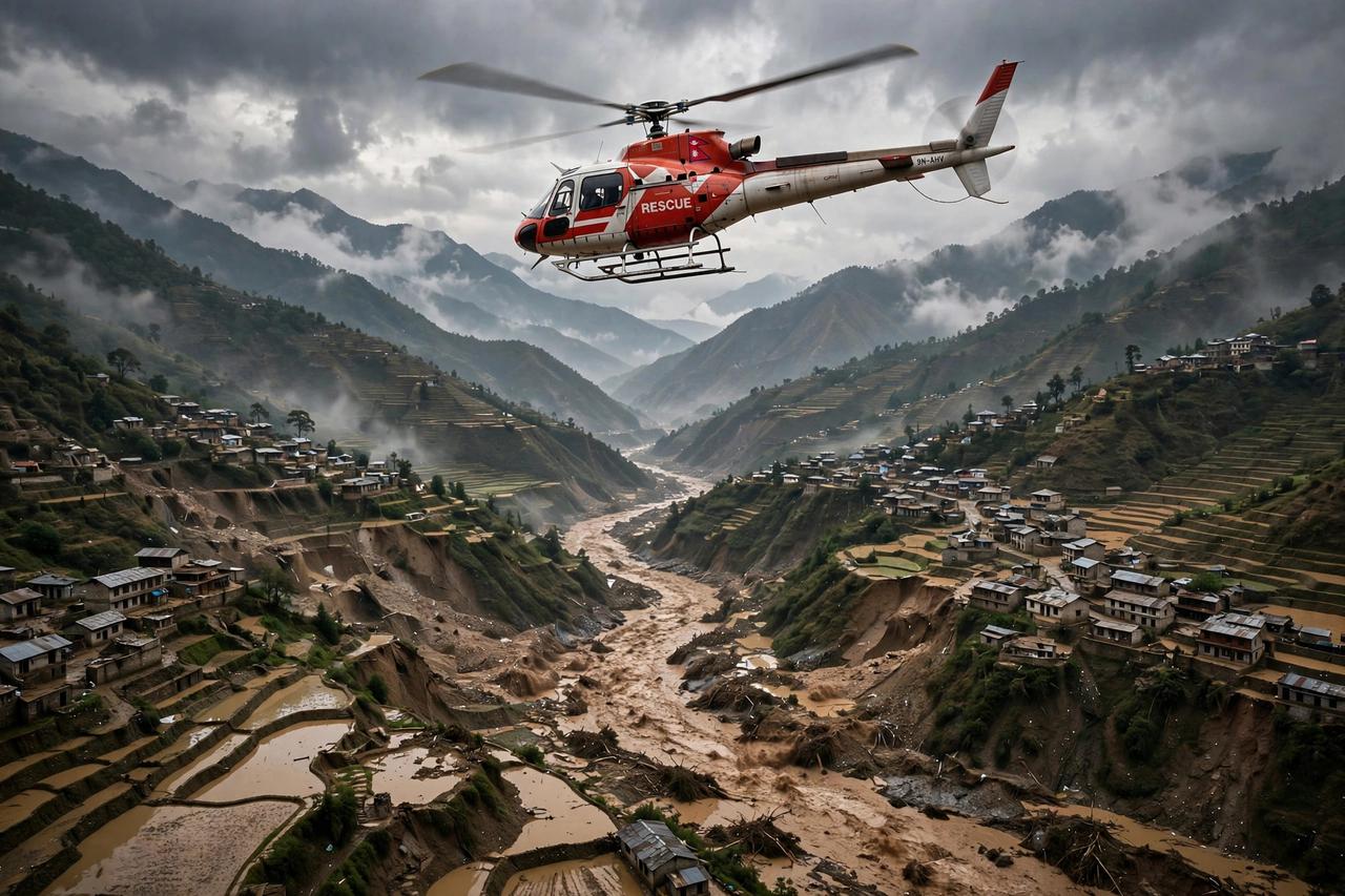
The Nepal Army deployed four helicopters and ground teams, rescuing 95 people including 9 foreign nationals on the first day, per the NDRRMA. By Monday, authorities told Reuters that 321 people, including 12 foreigners, had been rescued, with operations continuing as river levels receded.
More than 100 foreign trekkers remain stranded at different locations in the Manaslu region, unable to return because trails and bridges were swept away, a Manaslu Conservation Area official told Reuters. Authorities issued evacuation alerts across Dhading, Tanahun, Chitwan, and East and West Nawalparasi districts, warning residents along the Trishuli and Narayani rivers to stay away from riverbanks.
Why Nepal Keeps Flooding: The August Disaster
This Nepal flood hit a country still reeling. On August 26, 2026, a rock-ice avalanche broke off the Langtang Lirung glacier on the Nepal-China border, triggering catastrophic flooding along the Bhote Koshi-Trishuli river system. That disaster killed more than 1,400 people and left over 5,000 missing, according to disaster officials cited across multiple reports, making it one of the deadliest flood events in Nepal’s history.
The back-to-back disasters, barely 45 days apart, have intensified fears about mountain hazards in a warming climate. ICIMOD’s strategic lead on climate risks, Qianggong Zhang, said events like the Budhi Gandaki flood show why monitoring unstable slopes and river systems together is essential in steep mountain catchments, “where hazards can develop rapidly and affect communities far downstream.”
What Happens Next
Search and rescue operations are continuing in Gorkha, with the army’s composite quick reaction team deployed by air. The five missing persons remain unaccounted for. Authorities are monitoring water levels in the Budhi Gandaki, Trishuli, and Narayani systems, and engineers are assessing the damaged hydropower plants and bridges. With the investigation into the exact failure mechanism ongoing, ICIMOD and Nepal’s disaster authority are expected to release fuller assessments in the coming days. This article will be updated as new information arrives.
Why Nepal Is So Vulnerable to Floods
The October flood also exposed a seasonal blind spot: disaster preparedness in Nepal is geared toward the monsoon, but the Budhi Gandaki disaster struck in post-monsoon October, when vigilance was lower and trekking trails were full. Future preparedness will need to be year-round, because the mountains no longer follow the old calendar.
Nepal’s geography makes it one of the most disaster-exposed countries on Earth. The Himalayas rise from near sea level to Everest’s 8,849 meters within 150 kilometers, creating the world’s steepest inhabited terrain. Monsoon rains hammer these slopes every summer, glaciers and glacial lakes perch above valleys, and the young, fractured geology means landslides are constant. Climate change is amplifying every risk: warming melts glaciers faster, destabilizes slopes, and makes rainfall more erratic and intense.
The cruel pattern of 2026, a glacial collapse in August followed by a landslide-dam flood in October, shows how hazards chain together. A landslide blocks a river; the blockage fails; the flood destroys downstream. ICIMOD, the Kathmandu-based research body, has warned for years that monitoring slopes and rivers as connected systems, not separate problems, is essential. Early SMS warnings before the October 11 flood saved lives and proved that even simple alert systems work; expanding them to every at-risk valley is now the urgent lesson.
How to Help Nepal Flood Victims
Beyond money, attention has a half-life, and disaster recovery needs the long kind. The Budhi Gandaki flood will leave headlines within weeks, but rebuilding bridges, restoring hydropower, and reopening the Manaslu trails will take many months. Set a calendar reminder to check on recovery efforts in a few months; sustained giving and sustained attention are what turn a disaster response into actual recovery. Nepal’s mountain communities are resilient, but resilience shouldn’t have to mean doing it alone.
If you want to help, give money, not goods: cash lets relief organizations buy what’s actually needed locally. The Nepal Red Cross Society is the country’s primary domestic relief responder. Internationally, established disaster-relief organizations with Nepal operations accept earmarked donations. Nepal’s own NDRRMA coordinates the official response. Avoid donating to unverified social media fundraisers, however emotional the videos; disaster zones attract scams. And consider the longer term: rebuilding bridges, hydropower plants, and trails in Gorkha will take months, so recurring donations matter more than one-time spikes of attention.
The Manaslu Region: What Was Lost
There is reason for cautious hope. Nepal has rebuilt trekking regions before, after the 2015 earthquake closed Langtang and other areas, trails, teahouses, and bridges were restored within seasons, and trekkers returned. The Budhi Gandaki valley’s communities have the same resilience, and with the world’s attention briefly on Gorkha, the resources for rebuilding may follow. Recovery is not a question of if, but of how fast.
The flood struck one of Nepal’s most treasured trekking areas. The Manaslu Circuit is among the great Himalayan treks, circling the world’s eighth-highest mountain through villages like Jagat and Salleri Bazaar, both badly damaged. For local communities, trekking isn’t recreation, it’s the economy: teahouses, guides, and porters depend on the autumn season now underway. With trails and bridges washed out and 100+ trekkers evacuated, the region faces a lost season on top of physical destruction. Recovery here means rebuilding both infrastructure and livelihoods, and it will be measured in years, not weeks.
Nepal’s Disaster Response System
Nepal has built real disaster-response capacity since the devastating 2015 earthquake. The NDRRMA (National Disaster Risk Reduction and Management Authority) coordinates national response, district emergency operation centers manage local efforts, and the Nepal Army provides helicopter rescue and engineering support, as seen in Gorkha. The Department of Hydrology and Meteorology issues flood forecasts, and SMS-based early warnings, credited with saving lives on October 11, represent a major step forward. Gaps remain: remote valleys still lack automated monitoring, landslide-dam outburst floods give little warning, and the back-to-back disasters of 2026 have stretched resources thin. International support through the UN system and bilateral partners supplements the national effort during major events.
Nepal’s Monsoon Calendar: When Floods Strike
Timing matters for understanding risk. Nepal’s monsoon runs roughly June through September, when most flooding occurs. October is normally post-monsoon trekking season, which is why the October 11 flood was so shocking: trails were full of trekkers expecting clear skies. Glacial lake outburst floods peak in late summer as meltwater accumulates. Landslide-dam floods like Budhi Gandaki can strike any time after heavy rain destabilizes slopes. For travelers: monsoon season means avoiding river valleys; post-monsoon is generally safest, but 2026 proved that “generally” isn’t “always.” Check NDRRMA advisories before any mountain travel.
Frequently Asked Questions
What caused the Nepal flood in October 2026?
A landslide blocked the Budhi Gandaki River near Chumchet in Gorkha district; the temporary natural dam failed around dawn on October 11, releasing a debris-filled flash flood downstream. Nepal’s disaster authority and ICIMOD both point to the landslide-dam breach as the likely trigger.
How many people died in the Nepal flood?
As of the latest reports, there are no confirmed fatalities from the October 11 flood, but five people are missing and unaccounted for. The earlier August 2026 flood was far deadlier, killing more than 1,400.
Where in Nepal did the flooding happen?
In Gorkha district in central Nepal, along the Budhi Gandaki river corridor, affecting villages including Chumchet, Salleri Bazaar, and Jagat Bazaar in the Manaslu trekking region, about 100 km west of Kathmandu.
Are tourists affected by the Nepal flood?
Yes. More than 100 foreign trekkers were stranded in the Manaslu region after trails and bridges were destroyed, and the Nepal Army airlifted foreign nationals among the rescued. Check with tour operators and embassies before traveling to the region.
Is it safe to travel to Nepal right now?
Kathmandu and most tourist areas are unaffected, but the Manaslu/Gorkha region should be avoided until authorities declare trails and bridges safe. Monitor advisories from Nepal’s disaster authority and your government’s travel guidance.