What Is the Ring of Fire? The 40,000 km Belt of Volcanoes and Earthquakes, Explained

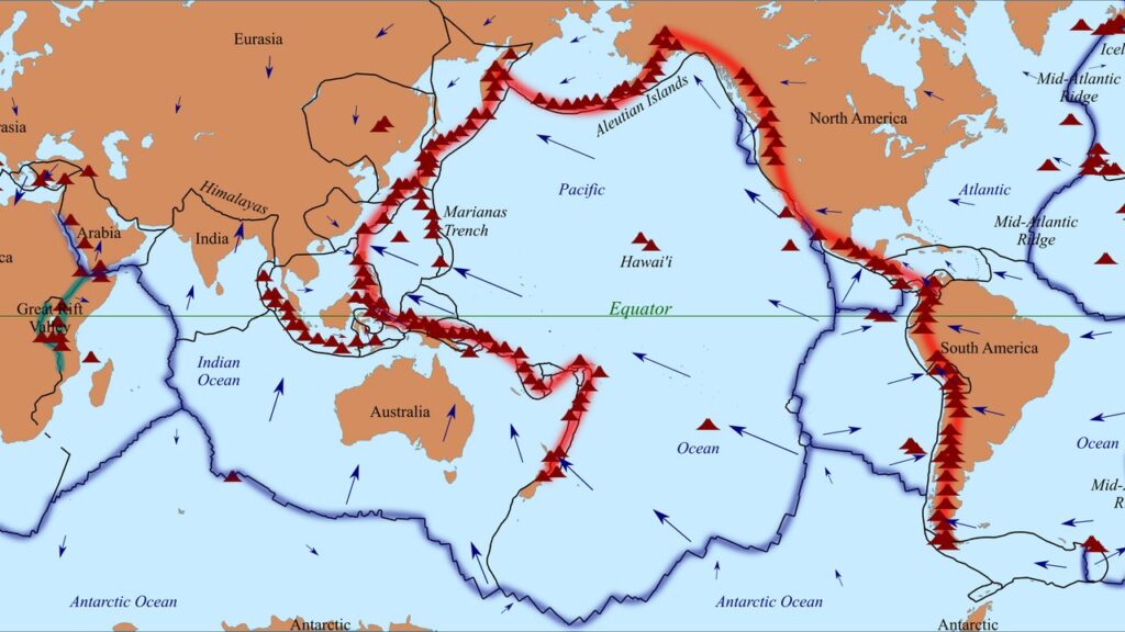
Some names in geography are metaphors, and some are warnings. The Ring of Fire is both. It is the belt around the Pacific Ocean where most of the world’s volcanoes stand and most of its earthquakes strike — a 40,000-kilometer horseshoe of trenches, volcanic arcs, and moving plates. If you live anywhere on the Pacific rim, you live on its edge, whether or not you have ever heard its name.
Students often imagine the Ring of Fire as a thing — a crack, a wall of volcanoes visible from space. It is better understood as a pattern: the trace left on the map by several tectonic plates diving beneath their neighbors, all the way around one ocean. This guide gives you the definition in one paragraph, the numbers in one table, and then walks the ring itself, shore by shore, so the geography sticks. By the end you should be able to sketch the horseshoe on a blank map and say which plates are sinking along each stretch of it — which is the level of understanding a definition alone never gives you.
The Ring of Fire, in One Paragraph
The Ring of Fire is an area where a large number of earthquakes and volcanic eruptions occur in the basin of the Pacific Ocean. In a 40,000 km (25,000 mi) horseshoe shape, it is associated with a nearly continuous series of oceanic trenches, volcanic arcs, and volcanic belts and plate movements. It has 452 volcanoes and is home to over 75% of the world’s active and dormant volcanoes. It is sometimes called the circum-Pacific belt — the belt around the Pacific — and it is a direct result of plate tectonics: the movement and collisions of lithospheric plates. That is the whole definition. Everything else in this article is those sentences, unpacked.
The Numbers
| Measure | Figure |
|---|---|
| Length of the belt | 40,000 km (25,000 mi), in a horseshoe shape |
| Volcanoes on the ring | 452 |
| Share of the world’s active and dormant volcanoes | Over 75% |
| Share of the world’s earthquakes | About 90% |
| Share of the world’s largest earthquakes | 81% |
Read the last two rows together, because they carry the real point. The ring is not merely where volcanoes happen to be; it is where the Earth’s crust is most actively being recycled, and earthquakes are the other half of that story. For scale, the next most seismically active region, the Alpide belt — which extends from Java to Sumatra through the Himalayas and the Mediterranean, and out into the Atlantic — accounts for only about 5–6% of earthquakes and 17% of the world’s largest earthquakes. The Mid-Atlantic Ridge is the third most prominent earthquake belt, which tells you how far behind the field is: the ring is not first among equals, it is in a category of its own.
All five figures above come from one open geology textbook source (CUNY’s Geology 101), which is why they are presented together: one source, one consistent set of numbers, no cherry-picking across websites that each count differently.
Where Exactly Does It Run?
Walk the horseshoe with me, starting in the southeast. The eastern section of the ring is the result of the Nazca Plate and the Cocos Plate being subducted beneath the westward-moving South American Plate — that collision raises the volcanic arc along South America’s western edge. Moving north, the Cocos Plate is being subducted beneath the Caribbean Plate, in Central America. Further up the Pacific coast, a portion of the Pacific Plate, along with the small Juan de Fuca Plate, is being subducted beneath the North American Plate.
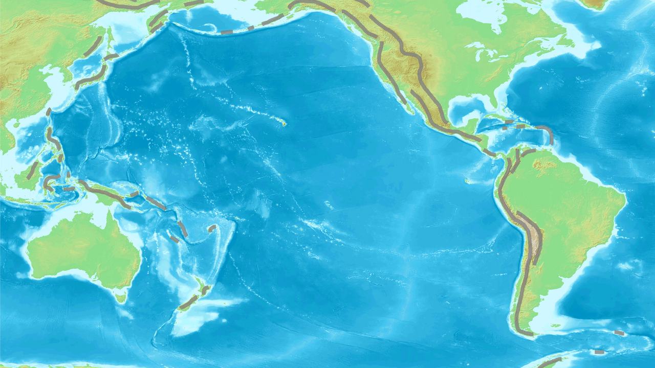
Along the northern portion, the northwestward-moving Pacific Plate is being subducted beneath the Aleutian Islands arc. Farther west, the Pacific Plate is subducted along the Kamchatka Peninsula arcs, on south past Japan. The southern portion of the ring is more complex, with a number of smaller tectonic plates in collision with the Pacific Plate — from the Mariana Islands, the Philippines, and Bougainville, to Tonga and New Zealand.
Two refinements students usually miss, and examiners love. First: Indonesia lies between the Ring of Fire — along its northeastern islands, adjacent to and including New Guinea — and the Alpide belt, which runs along its south and west from Sumatra, Java, Bali, Flores, and Timor; it sits on the seam of two belts, not squarely inside one. Second, and more commonly gotten wrong: this part of the ring excludes Australia, since Australia lies in the center of its tectonic plate, far from the subducting edges. Living in the southwest Pacific is not the same as living on the ring.
One more feature belongs on this walk, because it is famous and because it teaches the exception. The San Andreas Fault zone of California is a transform fault — a place where plates slide past each other rather than one diving under the other — which offsets a portion of the East Pacific Rise under the southwestern United States and Mexico. Its motion generates numerous small earthquakes, at multiple times a day, most of which are too small to be felt. Not every boundary on the ring subducts; some scrape sideways, and the earthquakes come either way.
Why Is It There? Subduction, Simply
Strip the mechanism to one paragraph — the full story has its own article. Around most of the Pacific, an oceanic plate is sinking beneath a neighboring plate, a process called subduction. As the sinking plate descends, it releases water into the hot mantle above it, that water lowers the mantle’s melting point, and the resulting magma rises to build a volcanic arc at the surface — while the grinding descent itself generates earthquakes along the way. That is why the volcanoes and the earthquakes share an address: both are products of the same sinking plates. For the step-by-step version, read how subduction zones build volcanoes — this article’s job is the map, and the map is a necklace of subduction zones.
Famous Volcanoes and Eruptions on the Ring
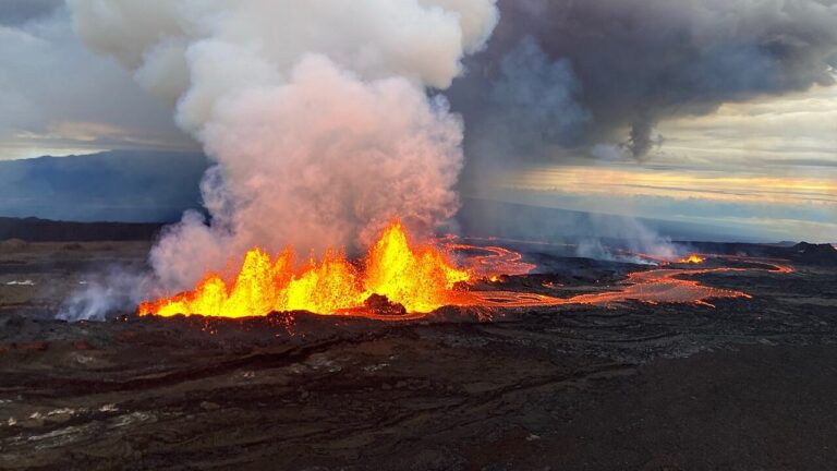
The honest way to introduce the ring’s famous activity is through its arcs and its record, because the ring’s celebrity is statistical before it is individual: 452 volcanoes strung along volcanic arcs and belts, producing eruptions as a routine of the system rather than as exceptions to it.
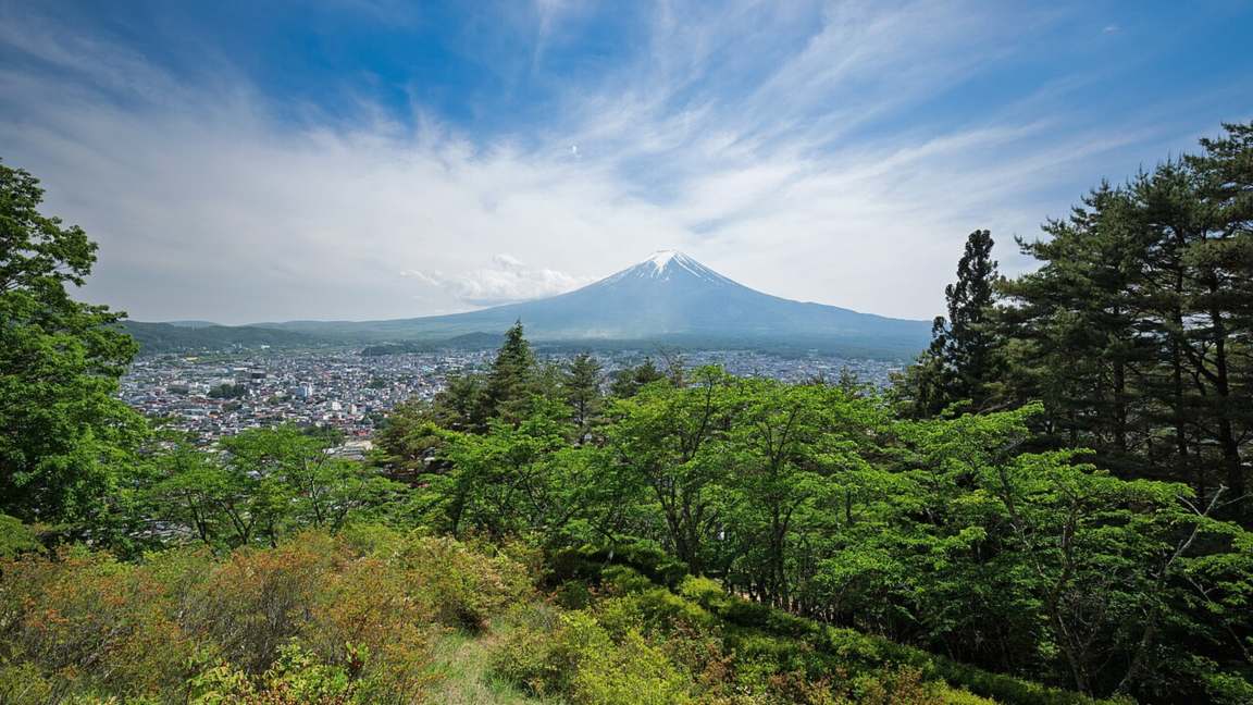
The volcanoes of the Japanese arcs, the Philippines, Indonesia’s northeastern islands, the Aleutian arc, and the Andes-side arc of South America are all ring volcanoes, built by the subduction described above — which is also why why some of these eruptions explode instead of flow is a question this cluster answers at length: arcs fed by subduction magma tend toward the explosive end of the range.
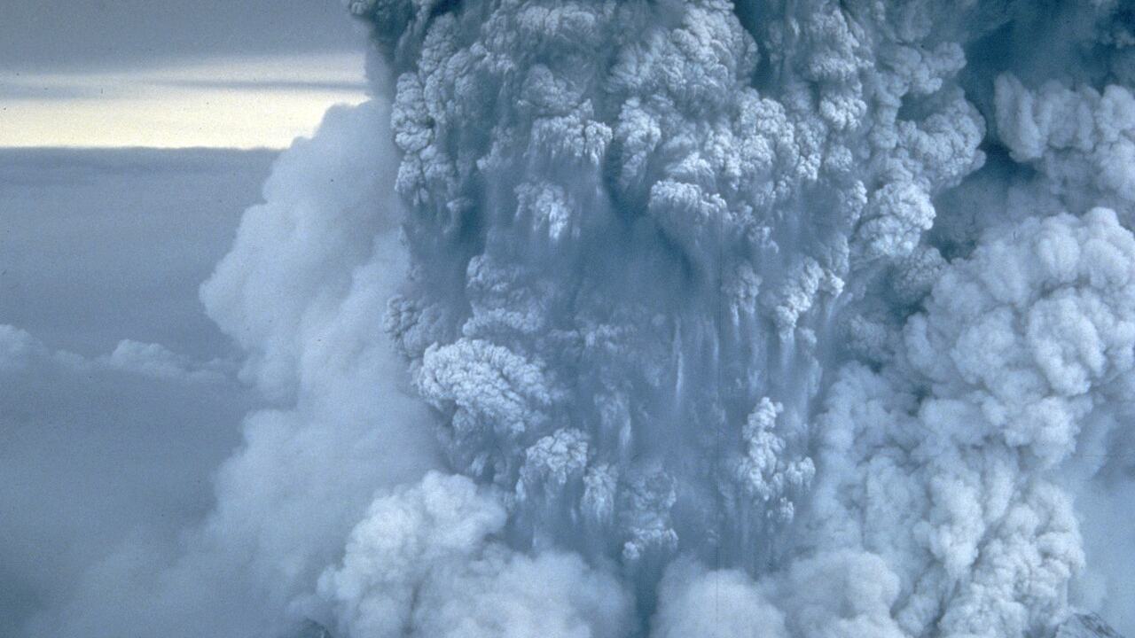
The ring’s most precisely documented famous events, in our source, are actually earthquakes — and they make the point about scale better than any adjective. The active Queen Charlotte Fault, on the west coast of Haida Gwaii in British Columbia, Canada, has generated three large earthquakes during the 20th century: a magnitude 7 event in 1929; a magnitude 8.1 in 1949, Canada’s largest recorded earthquake; and a magnitude 7.4 in 1970. One fault, on one stretch of the ring’s northeastern arc, producing the largest earthquake in a country’s records — that is what “81% of the world’s largest earthquakes” looks like when it has a date and a place.
Is the Ring of Fire Dangerous?
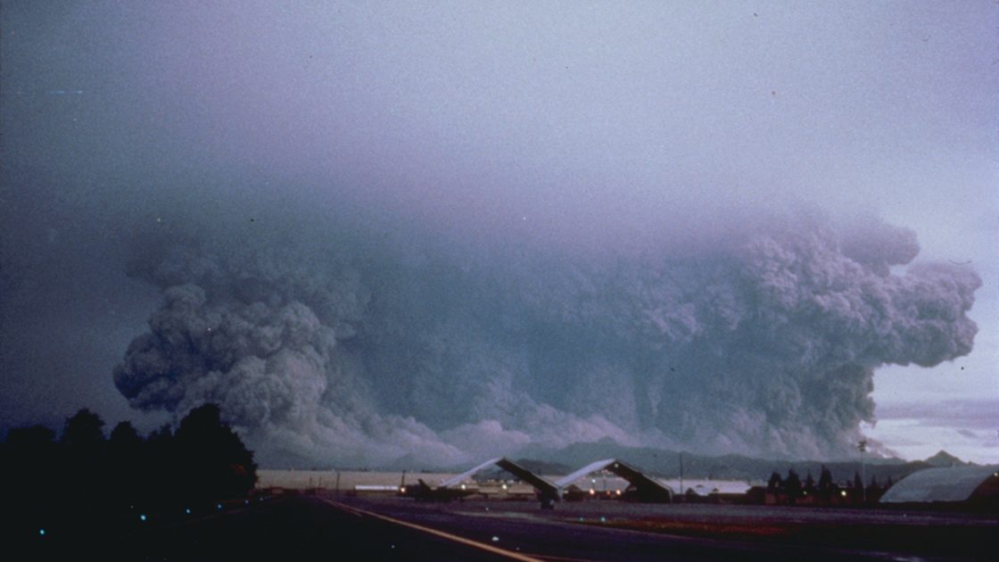
The numbers answer this without any dramatics. A belt holding over 75% of the world’s active and dormant volcanoes, and producing about 90% of its earthquakes and 81% of its largest ones, is by definition the most volcanically and seismically active region on Earth — and the coasts of the Pacific, on several continents, are settled land. The danger is not a single catastrophe waiting somewhere; it is a permanent condition of the geology, spread around an ocean, renewed every time the plates move — which is continuously. The practical response the geology itself suggests is the unglamorous one: these regions live with monitoring, building standards, and preparedness as facts of life, the way other regions live with their weather.
Notice, too, what the danger is not. It is not that any single volcano on the ring is uniquely threatening — it is that activity is normal there, at hundreds of volcanoes and along thousands of kilometers of plate boundary, all the time. Risk on the ring is a background condition to be managed, not an emergency that begins and ends. The ring is not going anywhere. Neither, the record suggests, is anyone else.
Frequently Asked Questions
Not a closed one. It runs in a 40,000 km horseshoe shape around the Pacific basin — open along the southern portion, where the belt becomes a complex set of smaller plates colliding with the Pacific Plate around the Mariana Islands, the Philippines, Tonga, and New Zealand. “Horseshoe of fire” would be more accurate and considerably less catchy.
452, according to the CUNY geology textbook — and together they account for over 75% of the world’s active and dormant volcanoes. The ring is not one volcanic system but hundreds, sharing one cause: subduction around the Pacific.
No — and this is the textbook’s own pointed nuance. The southern portion of the ring excludes Australia, because Australia lies in the center of its tectonic plate, away from the plate edges where subduction happens. New Zealand, on the Pacific Plate’s colliding boundary, is on the ring; Australia, in its plate’s quiet interior, is not.
Plate tectonics — specifically, subduction around the Pacific. The textbook’s summary is one line long: the ring is a direct result of plate tectonics and the movement and collisions of lithospheric plates. Oceanic plates sink beneath their neighbors around most of the Pacific basin; the sinking produces both the volcanic arcs and the earthquakes, which is why the two phenomena trace the same horseshoe on the map.
Its Pacific edge is. A portion of the Pacific Plate, along with the small Juan de Fuca Plate, is being subducted beneath the North American Plate along the west coast, and California’s San Andreas Fault — a transform fault on the same active margin — generates small earthquakes multiple times a day. The ring runs up the country’s western margin; the continental interior is not part of it.