
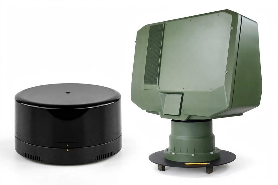
Every self-driving car carries both LiDAR and radar, which tells you something important: this is not a contest with a winner. It is a partnership between two sensors that see the world in fundamentally different ways — one with exquisite precision that falters in bad weather, one with crude vision that works through anything. Understanding the tradeoff is understanding why autonomous vehicles need sensor fusion at all.
I will compare them head to head: the physics, the strengths, the weaknesses, the costs — and then explain why the real answer is “both,” and what each one actually contributes. For the full context of how self-driving cars work, start there; this article zooms in on the two sensors people confuse most.
Table of Contents
- The One-Paragraph Version
- How Radar Works
- How LiDAR Works
- Head to Head: The Comparison
- Resolution: LiDAR’s Decisive Win
- Weather: Radar’s Decisive Win
- Range and Velocity
- Cost and Maturity
- Why Cars Use Both: Sensor Fusion
- The Failure Modes That Matter
- So Which Matters More?
- Frequently Asked Questions
The One-Paragraph Version
Radar uses radio waves: long wavelength, low resolution, sees through rain and darkness, measures speed directly, cheap and proven. LiDAR uses laser light: short wavelength, exquisite 3D resolution, blinded by heavy weather, historically expensive but getting cheap fast. Radar tells you something is there and how fast it is moving; LiDAR tells you exactly what shape it is and precisely where. Autonomous vehicles fuse both because neither is sufficient alone.
How Radar Works
Radar — Radio Detection and Ranging — is the older technology, born in World War II and refined over eighty years. An automotive radar unit emits radio waves (typically at 77 GHz for modern cars) and listens for reflections. Two measurements fall out naturally:
Distance, from the time delay of the echo — same principle as LiDAR, but with radio waves instead of light.
Velocity, from the Doppler shift — the change in frequency between the emitted and reflected wave directly reveals how fast the object is moving toward or away from you. This is radar’s killer feature: it measures speed directly, with no tracking or inference required. A radar return says “object, 60 meters, closing at 20 m/s” as a primary measurement, not a derived one.
The physics that limits radar is wavelength. At 77 GHz, the wavelength is about 4 millimeters — thousands of times longer than LiDAR’s infrared light. Longer wavelength means poorer angular resolution: radar can distinguish objects separated by degrees, where LiDAR distinguishes fractions of a degree. In practical terms, radar sees blobs where LiDAR sees shapes.
Modern imaging radar narrows this gap with many antenna elements and clever signal processing, approaching LiDAR-like resolution in some dimensions. It is the most interesting development in the radar world — but it is still radar: superb at motion, coarse at form.
How LiDAR Works
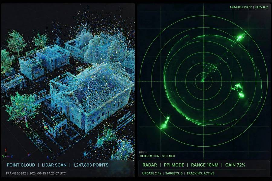
LiDAR — Light Detection and Ranging — fires laser pulses (usually infrared) and times their return. Light’s tiny wavelength (around 905 or 1550 nanometers — roughly 4,000 times shorter than radar’s) is the whole story: short wavelength means fine resolution. A LiDAR unit builds a point cloud — millions of precise 3D points per second, each located to centimeter accuracy.
Where radar gives you “blob at 60 meters closing fast,” LiDAR gives you the blob’s exact dimensions, its shape, the curb beside it, the overhang above it, the pedestrian behind it. It is the difference between hearing that someone is in the room and seeing them clearly.
The price of that precision: LiDAR’s short wavelength interacts strongly with water droplets. Rain, snow, and fog scatter the pulses, degrading range and filling the point cloud with noise. And LiDAR is active in a way that matters — it emits light, which means power draw, eye-safety limits on pulse energy, and potential interference between nearby units.
For the deeper dive, my article on the AI systems that process these sensors covers what happens after the raw measurements.
Head to Head: The Comparison
| Radar | LiDAR | |
|---|---|---|
| Signal | Radio waves (77 GHz) | Laser light (infrared) |
| Resolution | Coarse (blobs) | Fine (centimeter 3D shapes) |
| Weather | Excellent — sees through rain, fog, snow, darkness | Degraded by heavy rain, snow, fog |
| Velocity | Direct Doppler measurement | Inferred by tracking (except FMCW types) |
| Range | 200m+ (long-range radar) | 200m+ (high-end units) |
| Color/semantics | None | None (intensity only) |
| Cost | Tens of dollars, mature | Hundreds of dollars and falling |
| Moving parts | None (solid-state) | Depends on design |
| Maturity | Decades in automotive | ~15 years in automotive |
The table makes the complementarity obvious: each sensor’s strengths cover the other’s weaknesses almost perfectly. That is not a coincidence — it is why every serious autonomous vehicle carries both.
Resolution: LiDAR’s Decisive Win
This is not close. LiDAR’s point cloud resolves the world in three dimensions at centimeter scale: the height of the truck, the exact position of the lane edge, the pedestrian partially hidden behind a parked car (visible as a distinct cluster of points in the gap). Radar, even imaging radar, cannot do this. Its returns merge nearby objects into single detections and provide no meaningful shape information.
The practical consequence: perception systems built on LiDAR are more reliable at the core driving task of knowing precisely where things are. That reliability is the foundation everything else stands on.
Weather: Radar’s Decisive Win
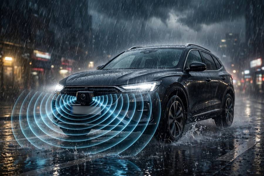
This is also not close, and it runs the other way. Radar’s long wavelength sails through rain, snow, fog, and darkness with minimal degradation. It is the sensor that keeps working when everything else struggles — the all-weather backbone.
This asymmetry shapes real deployment decisions. Robotaxi services restrict operations in heavy weather partly because their LiDAR-dependent perception degrades. Radar-heavy driver-assistance systems (adaptive cruise control, automatic emergency braking) work in conditions where full autonomy cannot. Weather is radar’s home turf, and it will remain so.
Range and Velocity
Velocity is radar’s signature win. Doppler shift gives instantaneous radial velocity — no tracking over frames, no inference, just physics. LiDAR traditionally infers velocity by watching objects move between scans (though FMCW LiDAR now measures it directly, at higher cost and complexity). For the specific task of “is that car braking,” radar is faster and more direct.
Cost and Maturity
Radar won the cost battle decades ago: automotive radar units cost tens of dollars, manufactured by the hundred million, integrated into everything from economy cars to trucks. It is a solved industrial problem.
LiDAR lost the cost battle for years — the infamous $75,000 Velodyne units — then staged one of the great comebacks in automotive history. Solid-state designs and scaled manufacturing brought prices into the hundreds of dollars, heading below $100. It is not yet radar-cheap, but it is no longer prohibitive. The remaining cost gap buys an enormous capability gap, which is why the industry keeps paying it.
Maturity favors radar: eighty years of development, exhaustive automotive validation, known failure modes. LiDAR is the newcomer — fifteen years in automotive, still evolving rapidly in form factor and capability. Newer means less field history, which matters for safety validation.
Why Cars Use Both: Sensor Fusion
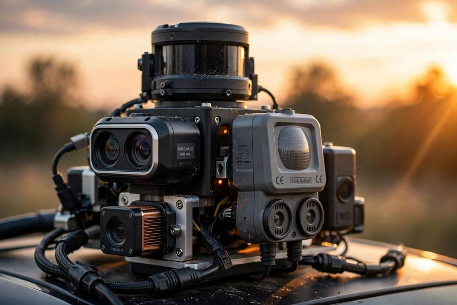
Here is the punchline: the comparison is interesting, but the engineering answer is fusion. Modern autonomous vehicles combine LiDAR, radar, cameras, and ultrasonics into a single world model, and the fusion is designed so that each sensor covers the others’ failures:
- Clear day: LiDAR provides precise geometry, cameras provide semantics (signs, lights, colors), radar confirms velocities. Full capability.
- Heavy rain: LiDAR degrades; radar and cameras (degraded but working) carry more weight. The car slows down and increases following distance — driving more cautiously because it knows its perception is weaker.
- Darkness: Cameras struggle; LiDAR (which brings its own light) and radar are unaffected. Night driving leans on the active sensors.
- Sun glare: Cameras blinded; LiDAR and radar unaffected.
The fusion system also does cross-validation: if LiDAR reports an obstacle but radar and cameras see nothing, the system can weigh the disagreement rather than blindly trusting one sensor. Redundancy is not just backup — it is error detection.
This is also why the “cameras only” versus “full sensor suite” debate matters so much. Dropping LiDAR does not just remove a sensor; it removes the redundancy architecture. Whether AI can compensate is the industry’s defining bet.
The Failure Modes That Matter
Each sensor fails in characteristic ways, and knowing them is knowing the technology’s limits:
Radar’s classic failure: stationary objects. Radar systems filter out static returns to avoid false alarms from signs, bridges, and guardrails — and sometimes filter out stopped vehicles too. Multiple fatal crashes involving driver-assistance systems trace to this: the radar saw the stopped fire truck and dismissed it as infrastructure. Imaging radar and better filtering are improving this, but it remains radar’s most dangerous blind spot.
LiDAR’s classic failure: weather and spoofing. Heavy precipitation blinds it; researchers have demonstrated injecting fake objects into point clouds with aimed lasers. Both are active areas of defensive engineering.
For more on the complete sensor suite and how it all integrates, my pillar guide covers the full picture, and the AI tooling behind it covers the software side of the industry.
So Which Matters More?
If forced to choose — which I am, by the headline — the honest answer depends on the question:
- For precise autonomy (knowing exactly where everything is): LiDAR matters more. Nothing else provides centimeter 3D geometry.
- For all-weather reliability: radar matters more. It is the sensor that never quits.
- For the industry’s future: LiDAR’s cost collapse is the bigger story. Radar is mature and stable; LiDAR is rapidly getting cheaper and better, expanding what autonomy can do.
But the real answer remains: the question is wrong. Asking “LiDAR vs radar” is like asking “eyes vs ears” — the system needs both because the world demands both. The winners are the vehicles that fuse them well, not the sensor that wins on paper.
Frequently Asked Questions
LiDAR uses laser light for centimeter-accurate 3D mapping but struggles in heavy weather; radar uses radio waves with coarser resolution but works through rain, fog, snow, and darkness, and measures speed directly via Doppler shift. Self-driving cars use both.
For precision — knowing exactly where objects are — yes, LiDAR is decisively better. For all-weather reliability and direct velocity measurement, radar wins. Neither is sufficient alone, which is why autonomous vehicles fuse both sensors.
Because their strengths are complementary: LiDAR provides precise 3D geometry in good conditions, radar keeps working through bad weather and measures speed directly. Sensor fusion lets each cover the other’s blind spots, with redundancy for error detection.
Yes — this is radar’s superpower. Its long-wavelength radio waves pass through rain, snow, fog, and darkness with minimal degradation. It is the all-weather backbone of vehicle sensing, which is why driver-assistance features like adaptive cruise control rely on it.
This is radar’s known weakness. To avoid false alarms from signs and bridges, radar systems filter static returns — and sometimes filter out stopped vehicles too. Imaging radar and better algorithms are improving this, but it remains the sensor’s most dangerous blind spot.