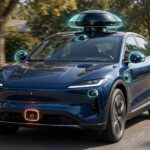

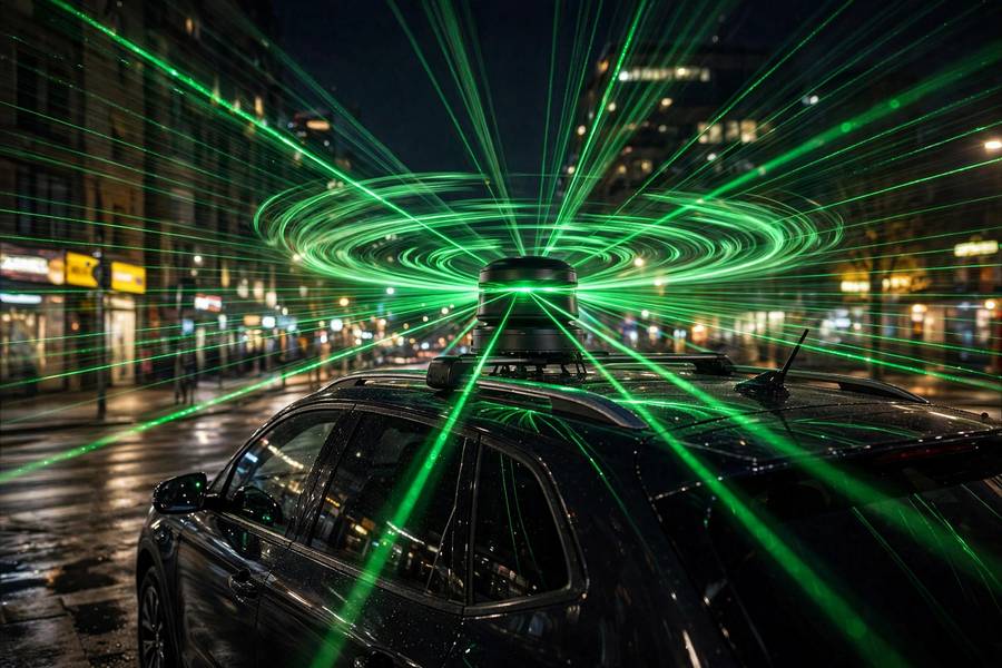
LiDAR is the spinning hat on top of self-driving cars — the cylinder that whirs around, firing invisible lasers in every direction. It is also, depending on who you ask, either the indispensable sense that makes autonomy possible or an expensive crutch the industry will eventually discard. Both camps agree on one thing: the physics is beautiful.
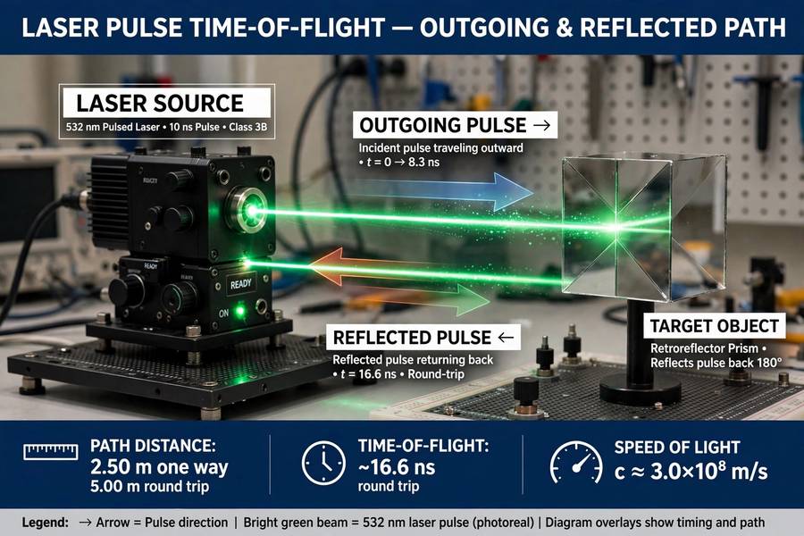
LiDAR stands for Light Detection and Ranging. The core idea fits in one sentence: fire a laser pulse at something, measure how long the reflection takes to come back, and since light travels at a known speed, that time tells you the distance. Do it millions of times per second in every direction, and you get a live 3D map of the world. Let me unpack exactly how.
This is one piece of the bigger picture I cover in my guide to how self-driving cars work.
Table of Contents
- The Core Principle: Time of Flight
- From Pulses to Point Clouds
- How the Sensor Sees in Every Direction
- What LiDAR Measures (and What It Doesn’t)
- Why Self-Driving Cars Love LiDAR
- Where LiDAR Struggles
- The Cost Collapse
- LiDAR Beyond Cars
- Frequently Asked Questions
The Core Principle: Time of Flight
Light travels at roughly 300,000 kilometers per second — fast enough that timing its round trip requires serious engineering, but the math is simple:
distance = (speed of light × time delay) / 2
(The division by two accounts for the round trip: out and back.)
A LiDAR unit fires a short pulse of laser light — typically infrared, invisible to human eyes — and starts a timer. When the reflection returns, the timer stops. If the round trip took 667 nanoseconds, the object is 100 meters away. Modern LiDAR does this measurement with centimeter accuracy, hundreds of thousands to millions of times per second.
There are variations on the technique. Time-of-flight (described above) is the most common. Frequency-modulated continuous wave (FMCW) LiDAR keeps the laser on continuously while varying its frequency, and measures distance from the frequency shift of the return — a bonus: it directly measures velocity too, like radar’s Doppler effect. FMCW is the emerging premium approach, harder to build but richer in data.
The wavelength matters. Most automotive LiDAR uses 905nm (near-infrared) — cheap components, but limited power because of eye-safety regulations. The 1550nm wavelength allows much higher power (it is absorbed by the eye’s lens before reaching the retina, so it is safer), giving longer range — but the components cost more. This is a real engineering tradeoff that affects how far a car can “see.”
From Pulses to Point Clouds
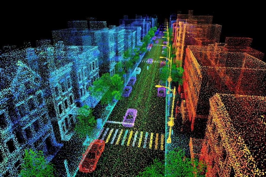
One distance measurement is trivia. A million per second is a point cloud: a three-dimensional scatter of points, each one a precise location where a laser pulse hit something solid. Visualized, a point cloud looks like the world rendered in glowing dots — ghostly, precise, beautiful.
Each point carries information:
- Position (x, y, z) — exactly where the reflection came from, to centimeter accuracy.
- Intensity — how strongly the surface reflected the laser. Lane markings blaze bright; asphalt is dim; license plates flare. Intensity is a crude but useful material sensor.
- Timestamp — when the measurement was taken, critical because the car is moving and the world is moving.
Software then interprets the cloud: clustering nearby points into objects, tracking those objects over time, classifying them (vehicle, pedestrian, cyclist, static obstacle). A car in the point cloud is unmistakable — a dense rectangular cluster of points moving coherently. A pedestrian is a smaller vertical cluster with that distinctive walking oscillation. The geometry is so precise that classification from LiDAR alone is remarkably reliable.
This is why perception engineers love LiDAR: it hands them the world’s geometry on a plate. Camera-based perception has to infer 3D structure from flat images — a genuinely hard inverse problem. LiDAR measures it directly. The difference between inference and measurement is the difference between guessing and knowing.
How the Sensor Sees in Every Direction
A single laser fires in one direction. To cover 360 degrees, LiDAR units scan:
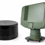
Mechanical (spinning) LiDAR — the classic design: the laser assembly physically rotates, sweeping beams around like a lighthouse. The spinning cylinder on Waymo’s cars is this type. It gives full 360° coverage with excellent performance, at the cost of moving parts (wear, vibration sensitivity, size).
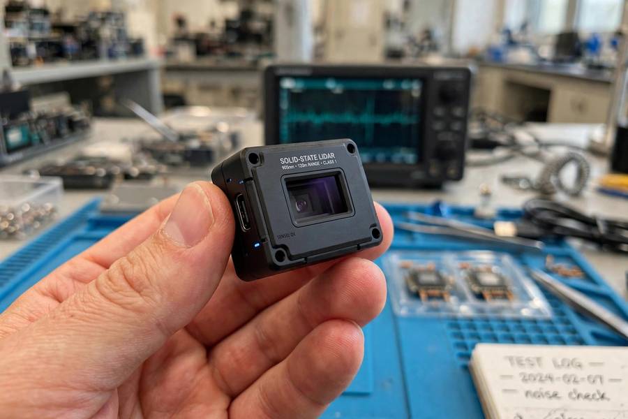
Solid-state LiDAR — no moving parts. Instead, the beam is steered electronically: with MEMS (tiny oscillating mirrors), optical phased arrays (interference patterns that steer light, like a phased-array radar), or flash LiDAR (illuminating the whole scene at once, like a camera flash, and reading the returns with a sensor array). Solid-state units are smaller, cheaper, more rugged — and typically have a narrower field of view, so cars use several of them.
The scan pattern matters too. A 64-channel LiDAR fires 64 laser beams at different vertical angles simultaneously while rotating, painting 64 horizontal lines around the car per revolution. More channels = denser point cloud = finer detail, at higher cost and data rates. The industry has been marching from 16 to 32 to 64 to 128 channels, with resolution doubling roughly every few years.
What LiDAR Measures (and What It Doesn’t)
LiDAR’s strengths are specific:
- Distance and geometry — its superpower. Centimeter-accurate 3D positions of everything around the car, out to 200+ meters.
- Works in darkness — it brings its own light. Night driving is no harder than day driving for LiDAR.
- Direct velocity (FMCW types) — measures how fast objects are moving, not just where they are.
Its blind spots are equally specific:
- No color, no text, no semantics. LiDAR cannot read a traffic light, a stop sign’s wording, or a brake light. It sees shapes, not meanings. (Intensity hints at materials, but a red light and a green light look identical.)
- Transparent and reflective surfaces confuse it. Glass, mirrors, and polished metal scatter or transmit the beam unpredictably. A glass bus shelter can be partially invisible.
- Weather degrades it. Rain, snow, and fog scatter laser pulses, creating noise — phantom points where droplets reflected the beam — and attenuating real returns. Heavy precipitation is LiDAR’s kryptonite.
- It is active, not passive. LiDAR emits energy, which means power consumption, potential interference between nearby LiDAR units (an increasingly real problem as more equipped cars share roads), and eye-safety power limits.
This is why no serious autonomous system uses LiDAR alone. It is the geometry specialist in a team: cameras read the signs, radar measures speed through rain, LiDAR maps the shapes. The full sensor fusion picture is where it all comes together.
Why Self-Driving Cars Love LiDAR
For autonomous driving, LiDAR solves the hardest perception problem — where exactly is everything — by measurement rather than inference. The practical consequences:
Localization. Matching live LiDAR scans against HD maps gives centimeter-accurate positioning. The map says “the curb is shaped like this here”; the LiDAR confirms it; the car knows exactly where it is. This loop is the backbone of how robotaxis navigate.
Reliable obstacle detection. A point cloud does not care about lighting, shadows, or camouflage. A pedestrian in dark clothing at night — nearly invisible to cameras — is a clear cluster of LiDAR points. Safety cases love this kind of physical reliability.
Simpler software. When geometry comes free, the AI can focus on understanding rather than reconstructing. Perception stacks built on LiDAR are, by most accounts, easier to develop and validate than camera-only stacks attempting the same performance. Time-to-market matters, and LiDAR buys time.
The counterargument — Tesla’s — is that LiDAR is a crutch: expensive, weather-limited, and unnecessary if your AI is good enough, since humans manage with vision alone. It is a legitimate position. It is also, currently, a bet: camera-only systems have not demonstrated the same safety record as LiDAR-equipped fleets. The scoreboard favors the lasers, for now.
Where LiDAR Struggles
Intellectual honesty requires the failure modes:
Heavy weather. I mentioned this, but it deserves emphasis: the conditions where driving is most dangerous are exactly where LiDAR degrades most. Torrential rain, blizzard snow, dense fog — the point cloud fills with noise and loses range. Engineers mitigate with filtering algorithms and sensor fusion, but physics sets a floor.
The interference problem. As LiDAR-equipped vehicles multiply, their lasers can interfere with each other — your car’s pulses contaminating my car’s returns. The industry is developing coding schemes (each unit modulating its pulses uniquely, like a signature), but a highway full of LiDAR cars is still a scaling question mark.
Cost and packaging. Even after the dramatic price collapse, LiDAR remains the priciest sensor on the vehicle, and integrating multiple units cleanly into car designs (rather than roof-mounted prototypes) is ongoing industrial-design work.
Adversarial potential. Researchers have shown LiDAR can be spoofed — injecting fake points into the cloud with carefully aimed lasers. It is a laboratory attack today, but the attack surface exists, and securing it is active research.
The Cost Collapse
This deserves its own section because it changed the industry’s economics. The original Velodyne HDL-64 — the spinning unit that launched the autonomous driving era — cost around $75,000. It was a research instrument, not a car part.
Then came the collapse: solid-state designs, MEMS mirrors, silicon photonics, Chinese manufacturers scaling aggressively. Automotive LiDAR units now cost hundreds of dollars, not tens of thousands, with credible roadmaps to under $100. What was once the reason autonomy “could never be affordable” is becoming a commodity component.
This matters because it undercuts the economic argument against LiDAR. If the sensor costs less than a set of tires, the debate shifts from “can we afford it” to “does it help” — and on pure capability, the answer is yes. The cost collapse is quietly settling the industry’s great sensor debate in LiDAR’s favor, one purchase order at a time.
LiDAR Beyond Cars
The technology is far bigger than autonomy:
- Mapping and surveying — airborne LiDAR maps terrain, forests, and cities in 3D; archaeologists use it to find lost cities under jungle canopy.
- Smartphones — the iPhone’s LiDAR scanner does room mapping and photography depth effects with the same time-of-flight principle, miniaturized.
- Robotics and drones — warehouse robots and delivery drones navigate with compact LiDAR.
- Climate science — atmospheric LiDAR measures aerosols, clouds, and pollution; NASA’s spaceborne LiDAR maps ice sheets and forests globally.
Every one of these works on the same principle: time light, measure distance, build the world in points. The self-driving car just happens to be the most demanding application — millions of measurements per second, interpreted in real time, with lives depending on the result. The AI models that interpret all that data are trained on staggering volumes of it, which is a story in itself.
Frequently Asked Questions
LiDAR fires laser pulses at objects and measures how long the reflections take to return. Since light travels at a known speed, the time delay reveals the exact distance. Doing this millions of times per second in all directions builds a live 3D map called a point cloud.
LiDAR stands for Light Detection and Ranging. It is the optical equivalent of radar: radar uses radio waves, LiDAR uses laser light, which allows far more precise distance measurements.
Yes — LiDAR brings its own light source (the laser), so darkness does not affect it at all. Night driving is no harder than day driving for LiDAR. Its weaknesses are heavy rain, snow, and fog, which scatter the laser pulses.
It used to be — early units cost around $75,000. But solid-state designs and scaled manufacturing have collapsed prices to hundreds of dollars, with roadmaps below $100. Cost is rapidly ceasing to be an argument against LiDAR.
No. LiDAR measures geometry — shapes and distances — but cannot see color or read text. A red light and a green light look identical to LiDAR. That is why autonomous vehicles pair it with cameras, which handle color, signs, and signals.